Central Java


Custom House
Central Java Province, as one of the Indonesia tourist destination areas, offers various kinds of tourist attractions whether natural, cultural, or man made features. Central Java is located exactly in the middle of Java Island.

It borders with West Java Province in the western part, while in the eastern part borders with East Java Province. On the part of the southern side lies also the province of Yogyakarta Special Region. Central Java is the island's cultural, geographic, and historic heartland.

Universities, dance schools, pottery, handicrafts, textiles and carving, give to the region a rich culture and interesting shopping. This is also the place of the famous Javanese temples of Borobudur.

Borobudur Temple

But it is not the only ones to be noted; Dieng plateau and Sukuh temple are worth a visit. Performing arts is still widely practiced, and traditional dance dramas (Wayang Orang) or shadow puppets (Wayang Kulit) performances are easy to find.
Mountains cross the entire central portion of the province. The cool slopes contain numerous hill resorts (Tawangmangu, Kaliurang, Sarangan).

The very first Moslem kingdom on the island was founded in 1511 at Demak, about 40 km from Semarang. Today Demak is a sleepy little town, however, its glory of the past is still visible from one of the major relics, which is still well preserved.
The Grand Mosque, a quaint blend of Hindu and Islamic architecture, still honored and worshipped by Javanese pilgrims.Surakarta, better known as Solo, is the cradle of Javanese culture in the province.
TV courts of Solo embody the noble value that the Javanese attach to grace and refinement, with majestic ceremonies and royal festivals still held with great pomp and circumstance. Although no longer the seat of power it once was, descendants of the royal houses of Solo are regarded as leaders of, Javanese culture and traditions, upholding standards of sophistication and conduct.
The rich and fertile plains of the region support an enormous population of over 30 million people. The low land plains are found alongside the northern beaches.
The high land plains are found in the Center of Central Java with mountains stretching lengthwise from the west to the east with a line of mountains, such as Mount Slamet (3,428 m), Mount Perahu (2,585 m), Mount Sindoro (3,135 m) Mount Sumbing (3,321 m), Mount Merapi (3,142 m), Mount Ungaran (2,050 m).
Near the border with East Java Province is Mount Lawu (3,265 m), while on the northern side there is Mount Muria (1,602 m). At the feet of these mountains will find pleasant and cool highland plains with beautiful panoramas such as Baturaden, the Dieng Plateau, Bandungan, Kopeng, Tawangmangu, Solo, etc.
Apart from these mountains there are some small mountains and lime mountains. The Biggest Rivers found in the Central Java are Serayu River, with its source from the Dieng Plateau and "Bengawan Solo" River.
The people of Central Java will welcome all of the tourists with hospitable and friendly. The population is about 30.7 million (based on census in 2002) or about 896 persons per square kilometer with living as farmer, trader, and official government.
Besides original tribe, some foreign tribes stay here such as Arabic, Chinese, Indian and Pakistani. "Kebaya" is representing traditional clothes wearied by woman.
Kebaya Clothing
custom clothing

West Java

Custom House West Java
West Java Province is located at part of western Java Island. The enchanting of Sunda land stretches from Sunda Strait in the west to the borders of Central Java in the east. The locals' people know West Java Province as the Land of Sunda.
The region is primarily mountainous, with rich green valleys hugging lofty volcanic peaks, many of which surround the capital of West Java province. The history of West Java is a story of trade, spices, and the rise and fall of powerful kingdoms.
In the late 1500's the region was ruled from mighty Cirebon, which still survives as a sultanate today, although a shadow of its former glory. West Java was of the first contact points in Indonesia for Indian traders and their cultural influences, and it was here that the Dutch and British first set foot in the archipelago.

This province has its own unique culture and language, both called Sundanese that is also used to call its people. The ancient kingdoms of Tarumanegara, Pajajaran, Banten and Cirebon would make interesting studies for the student of archaeology.
Cirebon is located on the border between West and Central Java, having a mixed culture originating from the ancient Cirebon and Banten kingdoms, resulting in similar customs and dialects of the two people, although Banten is located at the extreme western part of the province.

West Java province its self, is formed based on the Constitution number 11/1950 on the establishment of West Java. With the issuance of Constitution number 23/2000 on Banten Province, West Java Governor Assisting Territory I Banten was inaugurated as Banten Province with its territories comprising Serang Regency, Pandeglang Regency, Lebak Regency, Tangerang Regency and Mayoralty, and Cilegon Mayoralty.

After the change, at present West Java consists of 18 regencies, nine mayoralties, 584 districts, 5,201 villages and 609 sub districts.The capital city of West Java province is Bandung city. Bandung is situated 180 km southeast of Jakarta.

The city gamed fame in 1955 as the venue for the first Afro-Asian Conference, which brought together the leaders of 29 Asian, and African nations with the aim to promote economic and cultural relations and take a common stand against colonialism.
The road from Jakarta to Bandung passes through a beautiful panorama of mountains, paddy fields and small holiday resorts. An expressway connects the crowded capital city with Bogor and the mountain areas, and onward to Bandung.

It has a number of sea resorts on its western and southern coasts, which have modern hotels and are popular during the weekends. The Sundanese people are soft-spoken. The women of the Bandung region are known for their beauty. A lighthearted people who have a love for bright colors, their mournful "kecapi" music is memory of beautiful legends.


custom clothing

Special Capital Region [Jakarta]


custom house Betawi

Jakarta, the capital, is the largest city. It is located on the north-western coast of the island of Java on Jakarta Bay, at the mouth of the Ciliwung River. Jakarta is also the centre of activities for the whole of Indonesia.

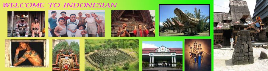
There are more than 300 ethnic groups in Indonesia with over 200 languages being spoken. Half the total population are Javanese with the balance being made up largely of Sundanese in West Java, Javanese in Central and East Java, Madurese in East Java and Madura, Balinese, the Coastal Malays, Buginese, Makassarese, and Bataks.

Being a big city, Jakarta's population is a composite of many racial strains, including Arab, Indian, Papuan, Dutch and Chinese. But the majority are of Malay origin.The city of Jakarta, founded on the former location of the pepper-seaport Sunda Kelapa at the mouth of the river Ciliwung, has always been a blooming centre of trade, which attrackted visitors from all over the archipelago.

The nowadays Jakarta is longsince not a pepper-seaport anymore. The 'Big Durian' is the fastest growing capital of the fifth biggest populous country of the world; a crowded metropolis with about ten milion people, a dynamic economy and a fast way of life.

In the 15th centuty Sunda Kelapa was an important outpost of the inland Hinduist kingdom Pajajaran. The city was embraced by a heavy battle for its part of the regional spice trade with other seaports along the Malaca Street and the Sunda Strait.

In 1527 the seaport was occupied by troops of islamc sultanates of Banten and Demak, under the authority of the North-Sumatran Malay Fatahillah Khan, which married an princes from Banten.

He hated the Portuguese, which conquerred North-Sumatra in 1521, and made a trade deal over pepperdelivery with Pajajaran in 1522. Sunda Kelapa became a part of Banten soon, and since then it was called jayakarta (City of the victory).

The Portuguese were followed up by the Dutch at the end of the 16th century. The Dutch monopolized the spice trade completely, and scared away their concurrents with their good ships and well organized V.O.C.

In the beginning they worked from Banten, but in November 1610 they signed a trading-treaty with prince Wijayakrama of Pajajaran, which let the Dutch built a warehouse in Jayakarta. This little fortress, founded in 1611 east of the city, was moved to the bank of the Ciliwung in 1618, and was called Jacatra since then.

In the first place Wijayakrama let the Dutch for what they were. This all changed when in 1618 a certain Jan Pieeterszoon Coen promovated: from general-bookkeeping and head of the VOC offices in Banten en jayakarta to governor-general.

Image A canal in Jakarta

When Coen wanted to replace all trade to Jayakarta, Wijayakrama called in the English from Banten to drive away the Dutch. A long siege followed, in which the few Dutch were overwhelmed by an enourmous power.

The distrust against the three armies gave Coen the opportunity to hold his positions until the reinforcements from the Moluccas arrived. In March 1618 he broke the siege and totally demolished Jayakarta and the palace of the prince.

After that he reinfoces the old fortress into a big new fortress, "Het Kasteel" (the castle) During the siege the old fortress was renamed to Batavia, from the Bataviers which settled in Holland in the early ages.
This name, the city would carry from 1622 until the end of theDutch rule in 1942.Coen made Batavia into the military and governmental capital of a mighty traving imperium, which stretched from Cape Hope to India, and from the Indonesian archipelago towards Formosa (Taiwan) and Japan.

In 1628 and 1629 attachs of sultan Agung and the powerfull mid-Javanese kingdom of Mataram were foiled, at a cost of great destruction. During the second siege, Coen died of cholera.His successor, governor-general Jacques Specx (1629 - 1632), rebuilt and reinforced the city from Coen's plans. In contrary to his predecessor, he gave the Chinese the right to demand taxes for services done by the Chinese.

Batavia fourished and its economical power got the city it's nickname "Queen of the East".In the next two centuries the faith of Batavia was the same as that of the VOC. The entire 17th century the economy of the city flourished on a profitable monopoly on spices, but in the 18th century the company had to deal with tremendous fluctuations in prices.

Corruption and high military costs endangered the position of the VOC more and more.The descending prosperity was also noticable in the city. The nice channels that Coen had designed to make batavia an eastern version of Amsterdam, seemed not suitable for tropical regions. They slowly suffocated, became polluted, and became breeding places of vermin.

In good, but badly ventilated Dutch buildings there were rats too much. The plaster was rotten because of the heat. Malaria-, dysenteria-, cholera- and typhoid-epidemics decimated the population. Fear of a revolt of the Chinese lead to the Massacre of the Chinese in 1740.

Batavia became economically dead and slowly but steadily the city started to become ramshackle. Year of bad management, costly wars and treason lead to the bankruptcy of the VOC, at the end of the 18th century it's territory was lost to the Dutch government.

Rise of a new city

Governor-general Deandels (1808-1810) ordered to tear down The Castle and the fortress walls. A new city centre was built in the less unhealthy south. Wide, three-lane boulevards and beautify government-buildings were constructed in neo-classical style, and formed the base of the modern day Jakarta.In 1811 British troops under Thomas Stamford Raffles entered Jawa and drove away the Dutch office. During his short period of leadership (in 1816 the Dutch got the office over the islands again) he introduced many new things and propagated the study of science and culture. The climax of his carreer was the founding of Singapore, a seaport that was to overshadow Batavia very soon.

Years of crisis and the New Order

The after-war Sukarno period left an inerasable impression on the modern Jakarta. Sukarno had the heavy task to lead a country that was torn apart by battle in the parties, and was robbed by the colonial aparatus.

Big parks, wide boulevards and heroistic monuments gave shape to his dream, but overshadowed the problems of the city. In the hope of a better living in the big city thousands of migrants flooded Jakarta.

The slum areas, poorness and desparation of the early sixties represent a negative time in the city's history. The succession of Sukarno by Suharto meant the dawn of an new era for Jakarta. Under the "New Order" plans to revive the city's economy and to modernise it were launched. The very simplified city council took care of hygene, education and supervision on burocracy, which were real hot items.

Still Jakarta is being embraced by problems that are similar to other fast growing cities in Third World countries. Investments aimed on a quick gain are being prevalated above the development of a primary infratructure with supporting systems.

For the visitor Jakarta is most of all a busy, colorfull metropolis, which houses aspects from all over the archipelago. For the milions that see Jakarta as their home, it's the true 'Ibu Kota', de Mother city of Indonesia.

custom wedding dress

Banten

custom house
Banten in the fifth century was part of Tarumanagara kingdom. A stone inscription, called Prasasti Cidanghiang, coming from Tarumanagara era can be found at Lebak area at the bank of Cidanghiang river, in Pandeglang Regency, Banten.

The Prasasti Cidanghiang, found in 1947, contains 2 lines of poetic sentences in Sanskrit written in Pallava characters. The inscription proclaims Purnawarman as the standard for rulers around the world.

After Tarumanagara power declined, probably due to series of invasions from Srivijaya kingdom, all Tarumanagara territory, including Banten, was controlled by Kingdom of Sunda. Based on travel records of Prince Bujangga Manik, a Hindu Sundanese monk who visited all of the holy Hindu sites in Java Island and Bali Island at the beginning of the sixteenth century AD, in his lontar manuscripts, which are saved in Bodleian Library of Oxford University of England since the 16th century, Banten was part of Kingdom of Sunda.

In this era of the Kingdom of Sunda, Banten became one of very important ports of the kingdom. Portuguese historical record tells that Kingdom of Sunda with great city of Dayo Pakuan Pajajaran (currently Bogor city), the town and lands and port of Banten, the port of Pontang, the port of Cigede, the port of Tangaram (Tangerang), the port of Sunda Kalapa, and the port of Cimanuk are justly governed.

In 1524/1525, Sunan Gunung Jati from Cirebon Sultanate (former vasal Kingdom of Sunda) together with Demak Sultanate armies seized port of Banten from the control of Kingdom of Sunda, and established Banten Sultanate affilialting to Demak Sultanate. Islam preachers have penetrated and introduced people the peaceful way of life of Islam and as result many people in the region embraced Islam as their belief.During 1552-1570, Maulana Hasanudin ruled as the first Sultan of Banten.

Banten then become a part of West Java province in 1925 when Dutch Colonial established West Java province, the first province in Indonesia, referring to a statement from Staatblad number 378.In the present day, the area of Sultanate of Banten is a province.

The province was established on 17 October 2000 through the Law Number 23/2000, but the peak of celebration to the establishment happened on 4 October 2000 when tens of thousands of citizen of Banten came to the People's Representative Council (DPR) building at South Jakarta, at the same time as the plenary meeting of the parliament to authenticate the law of forming the Province of Banten.


debus from banten


Traditional dance

Lampung


Lampung province is located at the extreme of south of Sumatra is overlooked, over flown by most tourists. In the past it was well known for its marvelous 'tapi' fabrics, some using real gold thread, and for its pepper.

But today, it is the location from ambitious transmigration projects, resettling farmers from over-populated Java. It boasts volcanoes, wildlife reserve, megalithic remain and a superb coastline of deep-cut bays and wonderful beaches.
Its capital is Bandar Lampung, is made up of twin cities that is Teluk Betung and Tanjung Karang. Way Kambas Nature Reserve is a 130,000 ha area of swamp and lowland forest with wild elephant, tapir and many other animals.
The name of Lampung province was taken from origin Lampungnese. Before Indonesia became independent country, a resident led Lampung region and the status was as residency area (Residentie lampungche districten) with many afdeling (afdeling Teloek betoeng, afdeling metroand afdeling kotabumi).

The villages/old town with traditional living characteristic could be found like sukadana, menggala, kenali, liwa, blambangan umpu etc.

Way Kambas


In the east part of Central Lampung there is a nature reserve named “Way Kambas“ which covers 130.000 hectares areas.

To achieve Way Kambas, an asphalted road is built. It takes 2 hours drive from Bandar Lampung. In nature reserve, there is the first elephant-training centre in Indonesia to train wild elephants which are capture from outside the area because they have disturbed the people's fields.

It is estimated there are about 500 elephants in Lampung, 250 of them are in Way Kambas. In this nature reserve, we can also find other wild animal such as Sumateran tigers, bears, tapirs and other animals such as deer, wild pigs and 286 bird species.

If we visit Way kambas, we can see the process of training wild elephants in the elephants training centre, an attraction of elephants are playing football, elephant safari, elephants are swimming and on certain occasions, we can also join catching the wild elephants and watch the elephants which are in the sexual mood which is very rarely found in the world.

custom clothing from Lampung

Bangka Belitung


Custom House of Bangka

Bangka-Belitung is one of Indonesia provinces. It includes two large islands, Bangka and Belitung, and several smaller ones, which lie east of Sumatra, northeast of South Sumatra province.

Bangka Belitung (BABEL) Islands province is the 31st Province in Indonesia, one of the newest provinces. Bangka Belitung get it’s approved as a new province in 2001 separated with south Sumatra. That acknowledgement is because of the people struggle.

The region that was a great tin mines, now already to reach the new phase in its life. It provisioned with the beautiful of nature, and the uniquely of culture, Bangka Belitung step to the better future. Supported by the “Serumpun Sebalai” spirit and abundant natural resources, it has been expecting a greater role to speed up the island region's development, namely Bangka regency, Belitung regency and Pangkal Pinang city through cooperation development. That potency of culture and tourism is also supported by its strategic location that can connect with other interesting area.

The sea transportation that become the most accessibility in Bangka Belitung Island, is support its economics activities among the Islands. The richness of Bangka Belitung Island of nature and tin mines until its maritime rich, make Bangka Belitung a magnet for the new comers to get a better life. A Balinese countryside is found in this Island named Giri Jati village, complete with all of Bali culture that remembering us to Bali Island.

Beside Bali tribe, we also can found Bugis tribe that adds the various cultures in Bangka Balitung Island. This Bugis tribe can be found in the fishermen village at Tanjung Binga. Otherwise, the original tribe, Melayu culture has strong influence in the traditional ceremony and religious ceremony.

One of the ceremonies is Rebo Kasan Ceremony that done by Air Anyer village people. It is believed that one day of a year, the God give His 320,000 angels in the world. The people must together to pray. This ceremony was held in the beach, but now on, it held in the mosque then continued to the beach. Formerly, this ceremony become the people party with its star party is ‘Dambus’ art.


Custom house of Belitung


The Beach


Matras Beach

It is located in Sinar baru village, Sungailiat district in eastern of Bangka Island. It about 9 Km from Sungailiat, it's considered as the best in Bangka Island. The beach is about 3 kilometers long and its width is almost 30 meters.

It is unspoiled white sandy beach with coconut trees around the beach area, the tropical breeze and sunshine. Enjoy the warm and clear waters of the blue sea or just have a cooling swim in the river entering the sea.

This beach commonly called as the Heaven Beach because it surrounded with coconut trees and visited by a lot of visitor. An easily accessible beach can be found in the northeast of Bangka, 48 km from Pangkal Pinang and 12 km from Sungai Liat.

Romodong Beach

Romodong beach is located at Bukit Ketok village, Belinyu district, Bangka regency. This beach is about 77 km of Sungailiat town. In this beach, the tourists can watch the sunset, because this beach is faced to west side.

The length of this beach is about 4 km; it is slope, white sandy and soft. Its water is very clear like a crystal. Enjoy the beautiful of Romodong. When it low tide, you can walk in the water until in the middle of clear sea. If we see around, we just find the boulders and white sand that spread in the beach. The winds that make the leaves wobbled greet the tourists who looking for an inspiration.


Custom clothing from bangka

South Sumatra


As fine veins the vast network of rivers in southern Sumatera cross an area as big as Ireland ( 104,000 sq.km. ). Five mighty rivers, a dozen important side rivers and a thousand small streams connect the scattered settlements in this vast and low populated province.
Near Palembang, most big rivers come together in the slow flowing Musi River, the biggest and widest of all. The Musi springs at the western side of the province as a small and twinkling stream, far away in the forest-covered Bukit Barisan, near the high peaks of Gunung Dempo ( 3159 metres ) and Gunung Patah ( 2817 metres ).


After she has left the cool highlands, the river falls and streams between the hills, along coffee plantationa and corn-, and ricefields. When reaching the flat lowlands, the river slows down, and crawls over the gradually descending plains towards the damping swamps along the coast.


A thousand years ago, Palembang was the capital of the powerfull maritime principalty of Srivijaya which had a vast trade network with Thailand, the Malay peninsula and the coastal areas of Jawa. The name comes from from limbang ( washing of gold ore ) and the early wealth of Palembang most likely originated from the gold from the river.


Old travel reports tell that the palace of the ruler contained a bassin wich was connected to the Musi River by a channel, which was a very big course of wealth for the king. Every day, the king threw one bar of gold into the bassin, which was shining like a goldfish. Above the river there was a refined smell of incense from the convents of Palembang, where more than one thousand monks lived and studied on buddhist writings.


Nowadays the river is dominated by the famous Ampera Bridge of Palembang. A little further upstream the Musi comes together with two main siderivers, the Ogan and the Komering, and widens towards a few hundred metres; ships until about 10,000 tonnes regularly make the hundred-kilometre trip from the coast to Boom Baru, a riverport of Palembang.


Along the shores of the Musi are piledwellings; some are a high as five metres above the waterlevel when it's low tide.Sumatera Selatan is the living area of the Malay and the centre of the Malay language and culture.
Malay is closely related with the Minangkabau language, and it's probable that Sumatera Selatan was populated by colonists from the Minangkabau region in the first centuries after Christ, which came to the coast to trade. Through the centuries their language changed from the one in the highlands. In the province, more than fifteen related Malay dialects are sporen currently.


On a small hill west of the city, Bukit Seguntang, the first king of Srivijaya and the ancestor of all Malay rulers descended. A second, and probably older, Bukit Seguntang is located near the village of Pariangan in the Minangkabau highlands.


For over three hundred years, Palembang was the most important centre of trade in Southeastern Asia, from the end of the 7th to the start of the 11th century. In that time, the city consisted of, just like nowadays, many kilometres of the Musi shorts.


While the ruler lived on the shore, his subjects built houses on the river itself. They populated a big fleet which formed the base of Srivijaja's rule over the sealane. Little remained from those times, but 24 archeological spots have been located, including the old palace, and the future promisses more interesting discoveries.


The bridge that spread above Musi River is becomes the main characteristic of Palembang city. It was built on 1962 - 1965. Ampera Bridge has 78m high of tower.
However, the special feature of this bridge that it can be opened and closed, the mechanism is no longer working, whereas is fact, it is the only bridge in Indonesia with the open-and-closed mechanism. Now it is only history.
The bridge has to be lifted up of the middle shares each time there every king sized ship, with height above nine meters, will pass by quickly. Both for going to downstream and also which going to the upstream.


Dempo Mountain

Mount Dempo is one of the natural tourism objects in Pagaralam. It is the highest peak in South Sumatra and might be reached directly from Palembang by car, after spending 6 hours more or less for about 295 kilometers. Grown in northern Sumatra (Indonesia) Highlands.
The liquor tends to be light with a hint of body and meatiness. Dempo Volcano is located at Lahat Regency, South Sumatra Province while little part belongs to Muna Regency of Bengkulu Province. Geographically, it lies at 04° 02'' SL and 103° 08'' EL.
The volcano has two peaks called Dempo and Merapi. The highest peak names Merapi with 3173 m high above sea level, while Dempo is about 3049 m. Dempo is a prominent 3173-m-high strata volcano that rises above the Pasumah Plain of SE Sumatra.

Bengkulu


Bengkulu is the smallest and lowest populated province of Sumatera - less than one million people on a surface of 21,168 square kilometers. The province covers an area of 500 km long stretch of unspoiled beaches, protected by a stretch of mountains which soon flow into the mighty Bukit Barisan.
Tigers and elephants wander through the remains of the original rainforest, where exotic rafflesia's and orchids grow.Bengkulu used to be the only British colony in Southeast Asia for over 140 years. It was founded as an alternative source for pepper, after the Dutch got rule over Banten in the 17th century.
This small British outpost along a low populated shore however has never been of much value: the importance of pepper on the world market was rapidly descending and Bengkulu was too far away from the main trade routes to mean anything. From 1685 to 1825 the books of the British East Indian Company reports very bad trade, boredom and early death because of malaria.

Fortress York, the first British base, was founded in 1685, followed by the construction of Fortress Marlborough two kilometers ahead in 1715. The British thought that the local population was 'indolent' and it was usual to punish their leaders.

When William Dampier was in Bengkulu in 1690, he found two of those leaders chained because 'they didn't bring in the demanded amount of pepper to the Fortress'. Outside protests of the British government, this form of punishment was common into the beginning of the 19th century.

Bengkulu was awakened from apathy during Raffles reign (1818 - 1824), but in 1825 the colony was transferred to the Dutch, in trade for the acknowledgement of the British influence on the Malaysian peninsula and Singapore. During his stay in Singapore, Raffles started to explore the sea, what eventually ended in the foundation of Singapore.

His enjoyment over the booming economy of his new colony was overshadowed by the sad fact that three of his four children died in Bengkulu. The British influence was kept limited to the small coastal planes. The mountainous hinterlands were annexed by the Dutch in the 19th century after a number of military expeditions.

Shortly before the turn to the 20th century the Dutch discovered that the mountains near Bengkulu contained tremendous gold deposits and the province soon became the biggest gold-producing province of the Dutch Indies.The population of Bengkulu consists of four main groups. The Rejang are the mountain people and form the majority.

They are divided into two groups: the highland Rejang and the coastal Rejang which have moved to the western lowlands. In the south live the Serawai, which are related with the Pasemah in the highlands around Pageralam en Gunung Dempo.

In the capital there are many Malay people. The province of Bengkulu has been inhabited ever since the pre-historic times, which is proved in the findings of stone tools in the northern area, and the discovery of megalith constructions and old drums from the Dongson type in the south.

The isolated island Enggano just of the southern beach is the living habitat of another group. For a long time the Engganese were protected by influences from outside, because of there remoteness, but eventually they were struck by pocks and other diseases which were brought to the island by Western expeditions at the end of the 19th century.

Around the end of the 19th century it is tried to bring fresh blood into the group, but that didn't succeed as well. During the reign of Soekarno, the island has temporarily been a prison island as well.


Fortress Marlborough

The colonial city of Bengkulu was founded by the British in 1685 (the called it 'Bencoolen'). 150 years later, in 1825, the Dutch took power until the Japanese invasion in 1942. Bengkulu still looks like the earlier descriptions: quiet and clean.
The remembrances of Bengkulu from the colonial past can best be seen when walking. Start early in the morning, because the mid-day heat will be tremendous.Start the trip along the west side of Jl. Jend. A. Yani, near the domed monument for Thomas Parr, the unpopular governor of Bengkulu; he was stabbed to death and decapitated in 1807, probably by Buginese people.
Parr, educated in Bengalen, was used to unending loyalty of a subjected and obeying population. Once in Bengkulu he tried to lower the power of the Buginese Corps. These were recruited to fill up the empty places in the British East India Company.
After the murder on Parr, several suspect leaders were executed and several villages were burned. The relations between the British and Indonesians wasn't always that bad, and the big Indo-European population brought a British critic to call Bengkulu 'a real Batavian colony', in which he meant to say that there was to much mixture between races.


The titan arum

The titan arum or Amorphophallus titanum is a flowering plant with the largest unbranched inflorescence in the world. The largest single flower is borne by theRaflesia arnoldiii; the largest branched inflorescence in the plant kingdom belongs to thetalipot palm (Corypha umbraculifera).

The titan arum was originally discovered by an Italian botanist,Ordoardo Beccari, in Sumatra in 1878. It thrives at the edges of rainforests near open grasslands. Though found in many botanic gardens around the world it is still indigenous only to the tropical forests of Sumatra.

Due to its fragrance, which is reminiscent of the smell of a decomposing mammal, the titan arum is also known as a carrion flower, the "Corpse flower", or "Corpse plant" (in Indonesian, "bunga bangkai" – bunga means flower, while bangkai means corpse or cadaver; for the same reason, the same title is also attributed to Rafflesia which, like the titan arum, also grows in the rainforest of Sumatra).


Custom clothing from Bengkulu

Source: Wikipedia
 
Minima 4 coloum Blogger Template by Beloon-Online.
Original Minima Template by Douglas Bowman